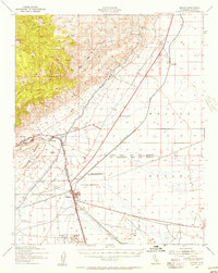
1943 Map of Mojave
USGS Topo · Published 1956About this map
The town of Mojave serves as the central hub of this 1943 survey, where the Southern Pacific and Atchison Topeka and Santa Fe railroads converge in the high desert. This era captures a landscape of transit and resource extraction, notably featuring the Los Angeles Aqueduct cutting through the northern canyons and the sprawling US Naval Reservation to the west of the main settlement. Small communities like Reefer City, Gold Town, and Sanborn line the rail corridors, reflecting the area's mid-century growth near the Tehachapi Mountains.
Find a feature on this map
28 named features on this map. Tap any name to fly to it.
Don’t see what you’re looking for? This feature index may not catch every label — zoom into the map to look around manually.
Map Details
Editions of this 1943 Mojave Map
2 editions found

Other maps of this area

1915 · Elizabeth Lake
USGS Topo · 1:125,000

1915 · Searles Lake
USGS Topo · 1:250,000

1915 · Mojave
USGS Topo · 1:125,000

1917 · Elizabeth Lake
USGS Topo · 1:125,000

1937 · Rogers Lake
USGS Topo · 1:48,000

1942 · Rogers Lake
USGS Topo · 1:62,500

1943 · Rosamond
USGS Topo · 1:62,500

1943 · Tehachapi
USGS Topo · 1:62,500

1943 · Cross Mountain
USGS Topo · 1:62,500

1943 · Emerald Mtn
USGS Topo · 1:62,500