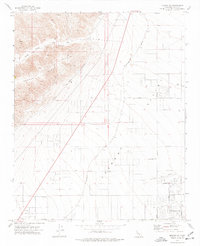
1973 Map of Mojave NE
USGS Topo · Published 1977About this map
Barren Ridge and the winding Tree Canyon dominate the northwestern high ground of this Kern County landscape, dropping sharply toward the desert floor. The industrial footprint of the region is defined by the Los Angeles Aqueduct, which skirts the base of the mountains, and the long diagonal of the Southern Pacific railroad line. The map illustrates the planned expansion of California City, showing an extensive grid of streets like Lindbergh Blvd and Cheyenne Blvd etched into the arid terrain near the California City Airport. These surveyed but largely undeveloped blocks reflect the mid-century ambitions of desert urbanization. Scattered Prospects and named points like Phil and Fremont suggest a history of exploration and transit between the mountains and the valley floor.
Find a feature on this map
29 named features on this map. Tap any name to fly to it.
Don’t see what you’re looking for? This feature index may not catch every label — zoom into the map to look around manually.
Map Details
Editions of this 1973 Mojave NE Map
4 editions found
Other maps of this area

1915 · Searles Lake
USGS Topo · 1:250,000

1915 · Mojave
USGS Topo · 1:125,000

1943 · Cross Mountain
USGS Topo · 1:62,500

1943 · Saltdale
USGS Topo · 1:62,500

1943 · Castle Butte
USGS Topo · 1:62,500

1943 · Mojave
USGS Topo · 1:62,500

1947 · Castle Butte
USGS Topo · 1:50,000

1947 · Plano
USGS Topo · 1:24,000

1947 · Mojave
USGS Topo · 1:24,000

1947 · Desert Butte
USGS Topo · 1:24,000