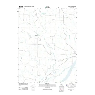
2012 Map of Mokane West
USGS Topo · Published 2012About this map
Missouri River bottomlands and the winding course of the Middle River dominate this landscape in Callaway County. The map documents the area surrounding Mokane, where the terrain transitions from the river's broad floodplains to the dissected uplands. Local family history is well-represented through several burial sites, including Mount Tabor Cemetery, Middle River Cemetery, and Riverview Cemetery. Smaller named settlements like Liberty, Musick, and Browns Ford serve as focal points for the rural road network, which includes State Road PP and State Road VV. The intricate drainage pattern of Prime Creek, Muddy Creek, and Clabber Creek illustrates the complex hydrology that has shaped this region's agriculture and settlement. Significant water bodies such as Katy Lake and Paul Herring Lake offer further landmarks for those studying the physical geography and land-use history of this river-aligned territory.
Find a feature on this map
69 named features on this map. Tap any name to fly to it.
Don’t see what you’re looking for? This feature index may not catch every label — zoom into the map to look around manually.
Map Details
Editions of this 2012 Mokane West Map
This is the sole edition of this map. No revisions or reprints were ever made.
Other maps of this area

1886 · Jefferson City
USGS Topo · 1:125,000

1890 · Fulton
USGS Topo · 1:125,000

1894 · Jefferson City
USGS Topo · 1:125,000

1928 · Fulton
USGS Topo · 1:62,500

1931 · Fulton
USGS Topo · 1:62,500

1939 · Jefferson City
USGS Topo · 1:62,500

1942 · Jefferson City
USGS Topo · 1:62,500

1944 · Millersburg
USGS Topo · 1:62,500

1945 · Mokane
USGS Topo · 1:62,500

1946 · Millersburg
USGS Topo · 1:62,500