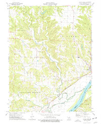
1975 Map of Mokane West
USGS Topo · Published 1977About this map
Missouri River bottomlands and the bluffs of Cote Sans Dessein dominate this mid-1970s landscape in Callaway County. The river corridor is a hub of transport and industry, featuring the Missouri Kansas Texas and Missouri Pacific railroads running parallel to the water. Significant local infrastructure is visible near the banks, including several Quarries and a Substation.
Find a feature on this map
33 named features on this map. Tap any name to fly to it.
Don’t see what you’re looking for? This feature index may not catch every label — zoom into the map to look around manually.
Map Details
Editions of this 1975 Mokane West Map
This is the sole edition of this map. No revisions or reprints were ever made.
Other maps of this area

1886 · Jefferson City
USGS Topo · 1:125,000

1890 · Fulton
USGS Topo · 1:125,000

1894 · Jefferson City
USGS Topo · 1:125,000

1928 · Fulton
USGS Topo · 1:62,500

1931 · Fulton
USGS Topo · 1:62,500

1939 · Jefferson City
USGS Topo · 1:62,500

1942 · Jefferson City
USGS Topo · 1:62,500

1944 · Millersburg
USGS Topo · 1:62,500

1945 · Mokane
USGS Topo · 1:62,500

1946 · Millersburg
USGS Topo · 1:62,500