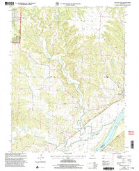
2000 Map of Mokane West
USGS Topo · Published 2003About this map
Mokane and the southern edge of the Mark Twain National Forest define this section of Callaway County at the turn of the millennium. The Missouri River forms the dominant southern boundary, carving a wide floodplain that includes St Aubert Island and a substantial Levee system. The transition from the river bottom to the uplands is marked by the Katy State Park Trail, occupying the former corridor of the Missouri-Kansas-Texas Railroad.
Find a feature on this map
28 named features on this map. Tap any name to fly to it.
Don’t see what you’re looking for? This feature index may not catch every label — zoom into the map to look around manually.
Map Details
Editions of this 2000 Mokane West Map
This is the sole edition of this map. No revisions or reprints were ever made.
Other maps of this area

1886 · Jefferson City
USGS Topo · 1:125,000

1890 · Fulton
USGS Topo · 1:125,000

1894 · Jefferson City
USGS Topo · 1:125,000

1928 · Fulton
USGS Topo · 1:62,500

1931 · Fulton
USGS Topo · 1:62,500

1939 · Jefferson City
USGS Topo · 1:62,500

1942 · Jefferson City
USGS Topo · 1:62,500

1944 · Millersburg
USGS Topo · 1:62,500

1945 · Mokane
USGS Topo · 1:62,500

1946 · Millersburg
USGS Topo · 1:62,500