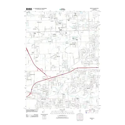
2012 Map of Mokena
USGS Topo · Published 2012About this map
Homer Glen and the surrounding Will County landscape exhibit a dense pattern of residential development and recreation at the start of the 21st century. The map highlights a transition from traditional agriculture, represented by the Bengston Pumpkin Farm and Garden Patch Farms, to an increasingly suburbanized environment defined by numerous named subdivisions like Kingstone Hills and Cedar Glen. This era of growth is balanced by significant preserved green spaces and waterways, including the winding course of Hickory Creek and Marley Creek. Genealogists and local historians can locate several important burial sites, such as Saint Michael Cem and the older Hadley Cem, which serve as anchors to the area's earlier settlement history. The map also documents the recreational character of the region with features like the Sanctuary Golf Course and Shady Oaks Camp.
Find a feature on this map
105 named features on this map. Tap any name to fly to it.
Don’t see what you’re looking for? This feature index may not catch every label — zoom into the map to look around manually.
Map Details
Editions of this 2012 Mokena Map
This is the sole edition of this map. No revisions or reprints were ever made.
Other maps of this area

1890 · Des Plaines
USGS Topo · 1:62,500

1892 · Joliet
USGS Topo · 1:62,500

1892 · Wilmington
USGS Topo · 1:62,500

1894 · Des Plaines
USGS Topo · 1:62,500

1900 · Des Plaines
USGS Topo · 1:62,500

1901 · Des Plaines
USGS Topo · 1:62,500

1918 · Wilmington
USGS Topo · 1:62,500

1923 · Joliet
USGS Topo · 1:62,500

1928 · Palos Park
USGS Topo · 1:24,000

1928 · Sag Bridge
USGS Topo · 1:24,000