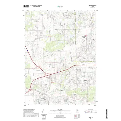
2018 Map of Mokena
USGS Topo · Published 2018About this map
Hickory Creek and Marley Creek flow through this section of the Illinois prairie, where the convergence of Will and Cook counties has fostered a landscape of expanding residential communities and preserved cemeteries. The map illustrates the growth of Homer Glen and Orland Park alongside established rail-oriented settlements like Mokena and New Lenox. Researchers will find a high concentration of burial grounds, including Saint Mary's Catholic Cemetery, Brooks Cemetery, and Hadley Cemetery, reflecting the area's deep-rooted pioneer and religious heritage. The transportation network is defined by historic corridors such as the Chicago Bloomington Trail and modern thoroughfares like W Maple Road, showcasing the transition from 19th-century trade routes to modern suburban connectivity near Marley and Gilletts.
Find a feature on this map
52 named features on this map. Tap any name to fly to it.
Don’t see what you’re looking for? This feature index may not catch every label — zoom into the map to look around manually.
Map Details
Editions of this 2018 Mokena Map
This is the sole edition of this map. No revisions or reprints were ever made.
Other maps of this area

1890 · Des Plaines
USGS Topo · 1:62,500

1892 · Joliet
USGS Topo · 1:62,500

1892 · Wilmington
USGS Topo · 1:62,500

1894 · Des Plaines
USGS Topo · 1:62,500

1900 · Des Plaines
USGS Topo · 1:62,500

1901 · Des Plaines
USGS Topo · 1:62,500

1918 · Wilmington
USGS Topo · 1:62,500

1923 · Joliet
USGS Topo · 1:62,500

1928 · Palos Park
USGS Topo · 1:24,000

1928 · Sag Bridge
USGS Topo · 1:24,000