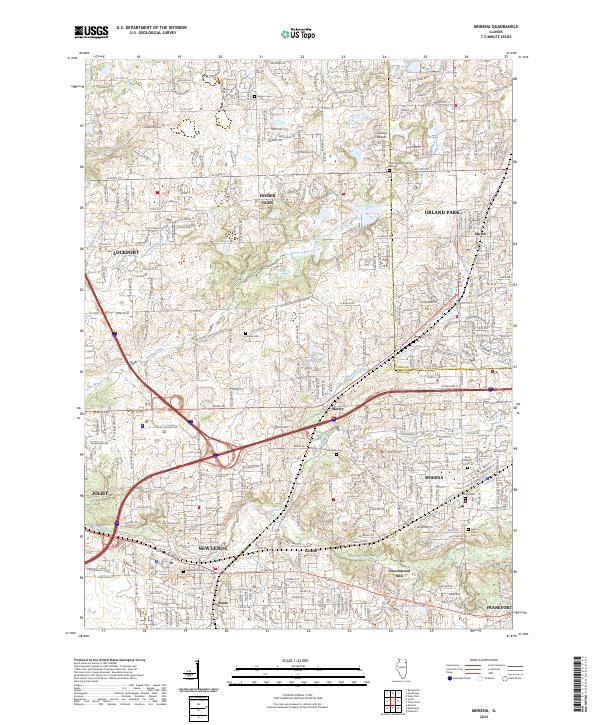
2024 Map of Mokena
USGS Topo · Published 2024About this map
The Cook and Will County boundary line bisects this modern landscape, where historical rural identifiers meet contemporary suburban growth. The area is anchored by the established centers of Mokena, New Lenox, and Homer Glen, while smaller locales like Marley and Alpine maintain their distinct placement along the local road network. For genealogists, the map is particularly rich in cemetery data, documenting small family or community plots such as Hadley Cem, Brooks Cem, and Marshall Cem, alongside larger parish grounds like Saint Marys Cem.
Find a feature on this map
49 named features on this map. Tap any name to fly to it.
Don’t see what you’re looking for? This feature index may not catch every label — zoom into the map to look around manually.
Map Details
Editions of this 2024 Mokena Map
This is the sole edition of this map. No revisions or reprints were ever made.
Other maps of this area

1890 · Des Plaines
USGS Topo · 1:62,500

1892 · Joliet
USGS Topo · 1:62,500

1892 · Wilmington
USGS Topo · 1:62,500

1894 · Des Plaines
USGS Topo · 1:62,500

1900 · Des Plaines
USGS Topo · 1:62,500

1901 · Des Plaines
USGS Topo · 1:62,500

1918 · Wilmington
USGS Topo · 1:62,500

1923 · Joliet
USGS Topo · 1:62,500

1928 · Palos Park
USGS Topo · 1:24,000

1928 · Sag Bridge
USGS Topo · 1:24,000