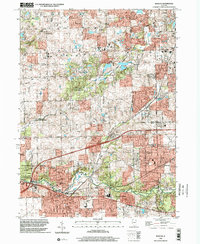
1998 Map of Mokena
USGS Topo · Published 2002About this map
New Lenox and Mokena anchor this landscape during a period of suburban expansion at the turn of the millennium. The map illustrates the persistence of older settlements like Marley and Alpine amidst a network of modern developments. Education and community life are highlighted through sites like Lincoln-Way High Sch and Providence High Sch, while local history remains visible at Brooks Cem and St Marys Cem.
Find a feature on this map
50 named features on this map. Tap any name to fly to it.
Don’t see what you’re looking for? This feature index may not catch every label — zoom into the map to look around manually.
Map Details
Editions of this 1998 Mokena Map
This is the sole edition of this map. No revisions or reprints were ever made.
Other maps of this area

1890 · Des Plaines
USGS Topo · 1:62,500

1892 · Joliet
USGS Topo · 1:62,500

1892 · Wilmington
USGS Topo · 1:62,500

1894 · Des Plaines
USGS Topo · 1:62,500

1900 · Des Plaines
USGS Topo · 1:62,500

1901 · Des Plaines
USGS Topo · 1:62,500

1918 · Wilmington
USGS Topo · 1:62,500

1923 · Joliet
USGS Topo · 1:62,500

1928 · Palos Park
USGS Topo · 1:24,000

1928 · Sag Bridge
USGS Topo · 1:24,000