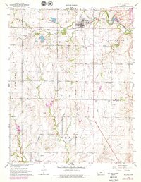
1962 Map of Moline
USGS Topo · Published 1979About this map
The town of Moline serves as the hub of this rural landscape, situated at the intersection of the Atchison Topeka and Santa Fe railroad and local trade routes. The 1960s terrain reflects a balanced economy of agriculture and extraction, notably marked by a large Quarry in the northeast and numerous oil wells dotting the hillsides. The landscape is deeply carved by drainage systems including Wildcat Creek and Bakers Branch, which flow through the designated districts of Wild Cat, Greenfield, and Elk Falls. Local social foundations are anchored by sites like Belknap Ch, Belknap Sch, and the Townhall. In the north, Santa Fe Lake provides a significant water source near the town's industrial infrastructure, such as the Sewage Disposal and Substation.
Find a feature on this map
23 named features on this map. Tap any name to fly to it.
Don’t see what you’re looking for? This feature index may not catch every label — zoom into the map to look around manually.
Map Details
Editions of this 1962 Moline Map
2 editions found
Other maps of this area

1885 · Sedan
USGS Topo · 1:125,000

1889 · Sedan
USGS Topo · 1:125,000

1955 · Wichita
USGS Topo · 1:250,000

1958 · Wichita
USGS Topo · 1:250,000

1962 · Moline
USGS Topo · 1:24,000
1962 · Elk Falls
USGS Topo · 1:24,000

1962 · Sedan
USGS Topo · 1:24,000

1962 · Elgin NE
USGS Topo · 1:24,000
1962 · Cloverdale
USGS Topo · 1:24,000
1962 · Grenola
USGS Topo · 1:24,000