2024 Map of Molino
USGS Topo · Published 2024About this map
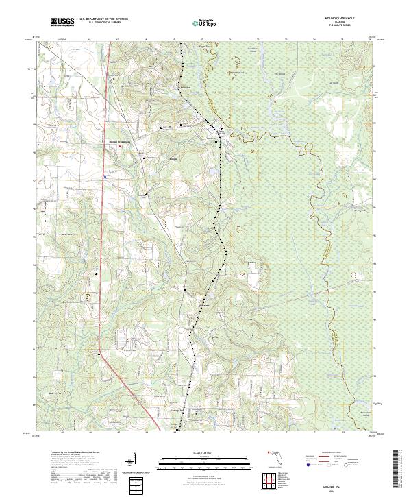
The Escambia River defines the landscape here, its braided channels and wetlands creating a complex network of islands and backwaters. Between the river and the inland heights, a string of established communities including Molino, Quintette, and Cottage Hill follows the ridge lines. The map reveals a dense concentration of local history markers, particularly through its numerous family and community burial grounds. From the Marlow Family Cem to the Barrineau Cem, these sites offer significant genealogical value for those tracing roots in the Florida Panhandle. The interplay between the low-lying Delaney River marshes and the residential corridors along Century Blvd illustrates the enduring settlement patterns of northern Escambia County. Named features like The Mound and Brosnaham Island suggest long-standing landmarks along the river's path, while the various churches and cemeteries ground the survey in the local social geography of the modern era.
Find a feature on this map
150 named features on this map. Tap any name to fly to it.
Don’t see what you’re looking for? This feature index may not catch every label — zoom into the map to look around manually.
Map Details
Editions of this 2024 Molino Map
This is the sole edition of this map. No revisions or reprints were ever made.
Historical Maps of Cottage Hill Through Time
3 maps found