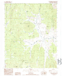
1987 Map of Monache Mountain
USGS Topo · Published 1987About this map
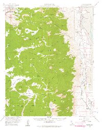
Monache Mountain dominates this high-altitude landscape within the Inyo National Forest and Sequoia National Forest. The 1980s terrain is defined by a vast network of meadows and seasonal water sources, including the expansive Monache Meadow and the serpentine Kern River. Significant landmarks for backcountry navigation include Jackass Peak and Granite Knob, while the Pacific Crest National Scenic Trail winds through the eastern portion of the quadrangle. The map details numerous springs such as Soda Spring and Oliuas Spring (Potable), suggesting a landscape where water access dictated movement. The survey illustrates a preserved wilderness character, with Golden Trout Wilderness and South Sierra Wilderness boundaries marking the protection of this Tulare County high country.
Find a feature on this map
35 named features on this map. Tap any name to fly to it.
Don’t see what you’re looking for? This feature index may not catch every label — zoom into the map to look around manually.
Map Details
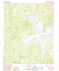
Editions of this 1987 Monache Mountain Map
2 editions found
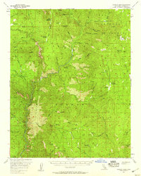
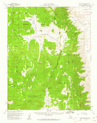
Other maps of this area

1905 · Olancha
USGS Topo · 1:125,000

1907 · Olancha
USGS Topo · 1:125,000

1948 · Fresno
USGS Topo · 1:250,000

1955 · Fresno
USGS Topo · 1:250,000

1956 · Fresno
USGS Topo · 1:250,000
1956 · Hockett Peak
USGS Topo · 1:62,500
1956 · Monache Mtn
USGS Topo · 1:62,500
1956 · Olancha
USGS Topo · 1:62,500
1956 · Kern Peak
USGS Topo · 1:62,500

1958 · Fresno
USGS Topo · 1:250,000