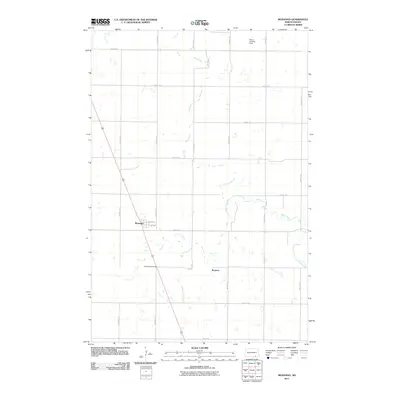
2011 Map of Monango
USGS Topo · Published 2011About this map
Monango and the nearby settlement of Boynton define the human landscape of this Dickey County prairie region. The town of Monango is organized around a traditional grid featuring Main Ave and 2nd Ave, reflecting the systematic development of North Dakota's agricultural hubs. Outside the town center, Monango Crossing marks a point of intersection in the open landscape, while the Werre Landing Strip serves as a small-scale aviation landmark in the northern portion of the quadrangle. The hydrology of the area is dominated by the meandering Maple River and its tributary, the South Fork Maple River, which create the primary natural variations in a terrain otherwise characterized by a strict section-line road network. These roads, including County Rd 1 and numerous numbered avenues, illustrate the enduring geometry of the Great Plains' rural infrastructure.
Find a feature on this map
22 named features on this map. Tap any name to fly to it.
Don’t see what you’re looking for? This feature index may not catch every label — zoom into the map to look around manually.
Map Details
Editions of this 2011 Monango Map
This is the sole edition of this map. No revisions or reprints were ever made.
Other maps of this area

1894 · Monango
USGS Topo · 1:62,500

1894 · La Moure
USGS Topo · 1:62,500

1894 · Fullerton
USGS Topo · 1:62,500

1895 · Lamoure
USGS Topo · 1:125,000

1896 · Edgeley
USGS Topo · 1:125,000

1918 · La Moure
USGS Topo · 1:125,000

1925 · Edgeley
USGS Topo · 1:125,000

1953 · Jamestown
USGS Topo · 1:250,000

1956 · Jamestown
USGS Topo · 1:250,000
1956 · Ellendale North
USGS Topo · 1:24,000