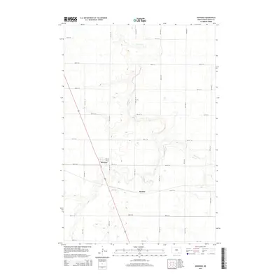
2014 Map of Monango
USGS Topo · Published 2014About this map
Monango and the small settlement of Boynton center this survey of southeastern North Dakota's agricultural landscape. The terrain is defined by the winding course of the Maple River, which meanders across the northern half of the sheet, and its tributary, the S Fork Maple River, which joins from the south. The area is gridded by a systematic network of section-line roads, including 87th St SE and 86th Ave SE, reflecting the deep-rooted homesteading patterns of Dickey County. In Monango, the local street plan is clearly visible, featuring Main Ave and 2nd Ave near the intersection with Cr-3. This 2014 representation provides a precise view of the rural infrastructure and watercourses that have sustained the local farming community for generations.
Find a feature on this map
23 named features on this map. Tap any name to fly to it.
Don’t see what you’re looking for? This feature index may not catch every label — zoom into the map to look around manually.
Map Details
Editions of this 2014 Monango Map
This is the sole edition of this map. No revisions or reprints were ever made.
Other maps of this area

1894 · Monango
USGS Topo · 1:62,500

1894 · La Moure
USGS Topo · 1:62,500

1894 · Fullerton
USGS Topo · 1:62,500

1895 · Lamoure
USGS Topo · 1:125,000

1896 · Edgeley
USGS Topo · 1:125,000

1918 · La Moure
USGS Topo · 1:125,000

1925 · Edgeley
USGS Topo · 1:125,000

1953 · Jamestown
USGS Topo · 1:250,000

1956 · Jamestown
USGS Topo · 1:250,000
1956 · Ellendale North
USGS Topo · 1:24,000