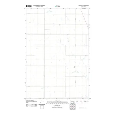
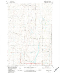
2011 Map of Monango NW
USGS Topo · Published 2011About this map
Potsdam Township in the southeastern reaches of North Dakota is defined by a rigorous section-line road grid and the meandering path of the South Fork Maple River. This 2011 survey illustrates a sparse agricultural landscape where local heritage is anchored by two rural burial grounds: Peace Cemetery in the northern portion of the township and Saint Pauls Cemetery further south. The land is punctuated by numerous small prairie potholes and depressions typical of the regional topography, often situated away from the main drainage of the river. The road network, including arterial routes like 81st St SE and 80th Ave SE, facilitates the movement of goods and people across this open prairie terrain, reflecting the enduring township-and-range settlement pattern of the Northern Plains.
Find a feature on this map
18 named features on this map. Tap any name to fly to it.
Don’t see what you’re looking for? This feature index may not catch every label — zoom into the map to look around manually.
Map Details
Editions of this 2011 Monango NW Map
This is the sole edition of this map. No revisions or reprints were ever made.
Other maps of this area

1894 · Monango
USGS Topo · 1:62,500

1896 · Edgeley
USGS Topo · 1:125,000

1925 · Edgeley
USGS Topo · 1:125,000

1953 · Jamestown
USGS Topo · 1:250,000

1956 · Jamestown
USGS Topo · 1:250,000
1956 · Ellendale North
USGS Topo · 1:24,000
1971 · Merricourt SE
USGS Topo · 1:24,000

1971 · Merricourt
USGS Topo · 1:24,000
1982 · Monango NW
USGS Topo · 1:24,000
1982 · Monango SW
USGS Topo · 1:24,000