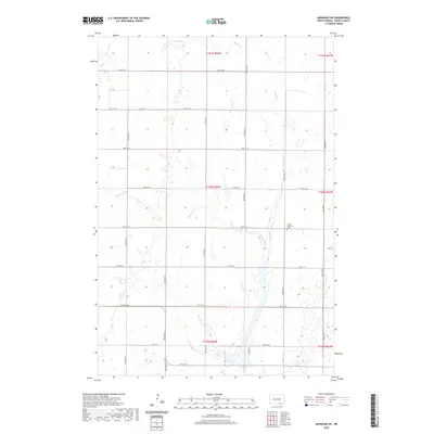
2020 Map of Monango SW
USGS Topo · Published 2020About this map
Elm River meanders across this rural landscape in Dickey County, carving a narrow corridor through the agricultural sections of the North Dakota plains. The terrain is defined by low-lying wetlands and the significant drainage of Bristol Gulch in the western portion of the quadrangle. Human settlement is sparse, characterized by a rigid grid of section-line roads such as 82nd Ave SE and 94th St SE that segment the vast fields. A focal point for local genealogy is the Christ Lutheran Cem, which sits near the intersection of several township lines. The presence of Lake Dr E in the southern reaches indicates localized development near the river's edge, contrasting with the expansive open acreage that dominates the surrounding townships.
Find a feature on this map
27 named features on this map. Tap any name to fly to it.
Don’t see what you’re looking for? This feature index may not catch every label — zoom into the map to look around manually.
Map Details
Editions of this 2020 Monango SW Map
This is the sole edition of this map. No revisions or reprints were ever made.
Other maps of this area

1894 · Monango
USGS Topo · 1:62,500

1894 · Ellendale
USGS Topo · 1:62,500

1896 · Edgeley
USGS Topo · 1:125,000

1899 · Ellendale
USGS Topo · 1:125,000

1925 · Edgeley
USGS Topo · 1:125,000

1953 · Jamestown
USGS Topo · 1:250,000

1953 · Ellendale South
USGS Topo · 1:24,000

1954 · Aberdeen
USGS Topo · 1:250,000

1956 · Aberdeen
USGS Topo · 1:250,000

1956 · Jamestown
USGS Topo · 1:250,000
Featured Places
- Hamburg Township, ND
- Keystone Township, ND
- Elden Township, ND
- Albion Township, ND
- Ellendale Township, ND