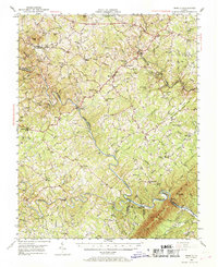
1951 Map of Moneta
USGS Topo · Published 1969About this map
Moneta serves as a central hub in this Virginia landscape, where the Virginian railroad cuts through the terrain, passing through a tunnel near Goodview. The mid-century geography is defined by the winding course of the Roanoke River as it forms the boundary between Bedford and Franklin counties. This river corridor, featuring landmarks like Horseshoe Bend and the Anthony Ford Bridge, reveals a rural economy dependent on the water, evidenced by Davis Mill and Valley Mills.
Find a feature on this map
94 named features on this map. Tap any name to fly to it.
Don’t see what you’re looking for? This feature index may not catch every label — zoom into the map to look around manually.
Map Details
Editions of this 1951 Moneta Map
3 editions found

Other maps of this area

1890 · Roanoke
USGS Topo · 1:125,000

1891 · Roanoke
USGS Topo · 1:125,000

1892 · Lynchburg
USGS Topo · 1:125,000

1921 · Chatham
USGS Topo · 1:48,000

1922 · Callands
USGS Topo · 1:48,000

1923 · Chatham
USGS Topo · 1:62,500

1924 · Callands
USGS Topo · 1:62,500

1925 · Rocky Mount
USGS Topo · 1:48,000

1927 · Rocky Mount
USGS Topo · 1:62,500

1929 · Roanoke
USGS Topo · 1:48,000