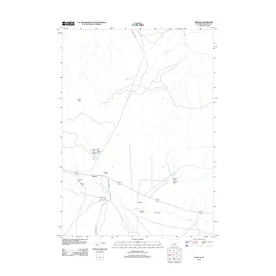
2012 Map of Moneta
USGS Topo · Published 2012About this map
Moneta serves as the central hub of this Fremont County landscape, situated at the junction of several critical backcountry routes. The settlement's connection to the surrounding high desert is traced through roads like Castle Garden Rd and Buck Camp Rd, which snake through the arid terrain of Alkali Flats and the Moneta Hills. This 2012 survey illustrates the vital importance of water management in the Wyoming basin, documented by Graham Reservoir and Frenchie Reservoir, alongside the intermittent drainage systems of Poison Cr and Moneta Draw. Remote family-named holdings such as Kanson Ranch and Webb Ranch reflect the enduring ranching tradition of the region, where life is dictated by the availability of water and the rugged network of state and local roads.
Find a feature on this map
22 named features on this map. Tap any name to fly to it.
Don’t see what you’re looking for? This feature index may not catch every label — zoom into the map to look around manually.
Map Details
Editions of this 2012 Moneta Map
This is the sole edition of this map. No revisions or reprints were ever made.
Other maps of this area

1952 · Seventy-one Reservoir
USGS Topo · 1:24,000

1952 · Squaw Butte NE
USGS Topo · 1:24,000

1952 · Squaw Butte
USGS Topo · 1:24,000

1952 · Gates Butte
USGS Topo · 1:24,000

1952 · Moneta
USGS Topo · 1:24,000

1952 · Lysite
USGS Topo · 1:24,000

1952 · Madden
USGS Topo · 1:24,000

1952 · Lysite SE
USGS Topo · 1:24,000

1952 · Moneta SE
USGS Topo · 1:24,000

1955 · Arminto
USGS Topo · 1:250,000