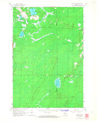
1965 Map of Monico NE
USGS Topo · Published 1966About this map
Three Lakes serves as the primary settlement hub in this mid-1960s Northwoods landscape, characterized by its complex network of glacial lakes and marshy lowlands. The area's specialized agriculture is evident in the Cranberry Bogs near James Lake, while the industrial past of the timber and transport era is marked by the Old Railroad Grade cutting through the Nicolet National Forest. Waterways like the Eagle River and Monico Creek wind through the township of Piehl, illustrating a terrain where seasonal drainage and timber management define the local economy. To the south, the village of Atkins sits along the Soo Line tracks, highlighting the historical importance of rail transit in connecting these remote northern Wisconsin communities. The survey detail also reveals the boundary between Oneida Co and Forest Co, providing clear documentation of political and natural borders in the 1960s.
Find a feature on this map
24 named features on this map. Tap any name to fly to it.
Don’t see what you’re looking for? This feature index may not catch every label — zoom into the map to look around manually.
Map Details
Editions of this 1965 Monico NE Map
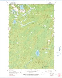
2 editions found
Other maps of this area

1928 · Three Lakes
USGS Topo · 1:48,000

1938 · Alvin
USGS Topo · 1:48,000

1938 · Three Lakes
USGS Topo · 1:48,000

1939 · Crandon
USGS Topo · 1:48,000

1940 · Monico
USGS Topo · 1:48,000

1941 · Crandon
USGS Topo · 1:48,000

1945 · Three Lakes
USGS Topo · 1:48,000

1946 · Alvin
USGS Topo · 1:48,000

1947 · Crandon
USGS Topo · 1:48,000

1950 · Monico
USGS Topo · 1:48,000