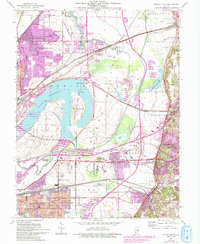
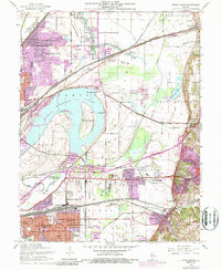
1954 Map of Monks Mound
USGS Topo · Published 1993About this map
Monks Mound and the surrounding earthworks of Cahokia Mounds State Park anchor this landscape, highlighting the significant Mississippian heritage located just east of the Mississippi River floodplain. The map reveals a complex intersection of ancient history and 20th-century development, where the massive Horseshoe Lake and its associated State Park sit adjacent to the industrial and residential expansion of Granite City and Collinsville. This edition, featuring 1993 revisions over a mid-century base, documents the post-war growth of suburban pockets like Maryland Place and State Park Place.
Find a feature on this map
65 named features on this map. Tap any name to fly to it.
Don’t see what you’re looking for? This feature index may not catch every label — zoom into the map to look around manually.
Map Details
Editions of this 1954 Monks Mound Map
5 editions found
Other maps of this area

1888 · St. Louis
USGS Topo · 1:62,500

1907 · Belleville
USGS Topo · 1:62,500

1927 · Alton
USGS Topo · 1:62,500

1927 · Edwardsville
USGS Topo · 1:62,500

1931 · French Village
USGS Topo · 1:24,000

1932 · Edwardsville
USGS Topo · 1:62,500

1933 · Granite City
USGS Topo · 1:24,000

1933 · Cahokia
USGS Topo · 1:24,000

1934 · Cahokia
USGS Topo · 1:24,000

1934 · Alton
USGS Topo · 1:62,500