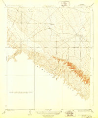
1923 Map of Monocline Ridge
USGS Topo · Published 1928About this map
The dramatic geological formation of Monocline Ridge dominates this 1921 survey of western Fresno County, showcasing the complex topography where the Tumey Hills meet the valley floor. Early petroleum infrastructure is evident at the Oil Pumping Station, a testament to the region's developing industrial base during the early twentieth century. Education for the era's rural ranching families was centered at the Tumey Gulch School, located near the intermittent drainage of Tumey Gulch. This map provides a high-resolution look at the section lines and township boundaries that defined land ownership in this arid landscape before modern intensive irrigation transformed the surrounding plains.
Find a feature on this map
6 named features on this map. Tap any name to fly to it.
Don’t see what you’re looking for? This feature index may not catch every label — zoom into the map to look around manually.
Map Details
Editions of this 1923 Monocline Ridge Map
3 editions found
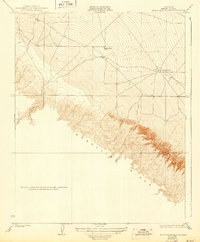
Other maps of this area

1912 · Coalinga
USGS Topo · 1:125,000

1913 · Panoche
USGS Topo · 1:125,000

1915 · Priest Valley
USGS Topo · 1:125,000

1921 · Tierra Loma School
USGS Topo · 1:31,680

1922 · Tufts Ranch
USGS Topo · 1:31,680

1922 · Chaney Ranch
USGS Topo · 1:31,680

1923 · Levis
USGS Topo · 1:31,680

1923 · Tierra Loma School
USGS Topo · 1:31,680

1923 · Monocline Ridge
USGS Topo · 1:31,680

1943 · New Idria
USGS Topo · 1:62,500