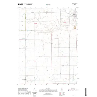
2019 Map of Monon
USGS Topo · Published 2019About this map
The town of Monon serves as a northern anchor in this part of White County, where the CSX rail line intersects the local grid. This 2019 survey captures the highly engineered landscape of Indiana's agricultural heartland, defined by an extensive drainage network including the Robinson Ditch, Hoagland Ditch, and Minch Ditch. These waterways support the surrounding farmsteads across the townships of t28n r5w and t27n r4w, illustrating the transition from natural streams like Honey Creek to modern irrigation and land management. Small clusters of settlement at Seafield and Reynolds punctuate the southern landscape, while several local burying grounds, including Monon Cemetery, Swisher Cemetery, and Palestine Cemetery, provide essential points of reference for those tracing family history in the region. The map shows the orderly progression of county roads, such as W State Rd 16, that connect these rural communities.
Find a feature on this map
41 named features on this map. Tap any name to fly to it.
Don’t see what you’re looking for? This feature index may not catch every label — zoom into the map to look around manually.
Map Details
Editions of this 2019 Monon Map
This is the sole edition of this map. No revisions or reprints were ever made.
Other maps of this area

1953 · Danville
USGS Topo · 1:250,000

1955 · Danville
USGS Topo · 1:250,000

1956 · Danville
USGS Topo · 1:250,000

1962 · Monticello South
USGS Topo · 1:24,000

1962 · Templeton NE
USGS Topo · 1:24,000

1962 · Monon NE
USGS Topo · 1:24,000

1962 · Brookston NW
USGS Topo · 1:24,000

1962 · Monon
USGS Topo · 1:24,000

1962 · Monticello North
USGS Topo · 1:24,000
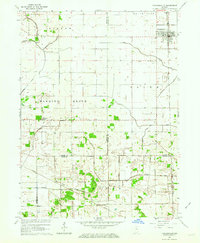
1962 · Francesville
USGS Topo · 1:24,000