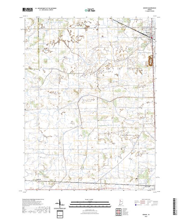
2022 Map of Monon
USGS Topo · Published 2022About this map
Monon serves as the primary northern hub of this landscape, where the local grid meets a complex network of agricultural drainage that defines the region's development. Situated in northwestern Indiana, the area is characterized by a high density of artificial waterways such as Hoagland Ditch, Robinson Ditch, and Obrien Ditch, which channel water toward the natural course of Honey Creek. These ditches follow the township and range boundaries of t28n r5w and t28n r4w, reflecting a highly engineered rural environment. To the south, the small settlements of Seafield and Reynolds sit along the rail corridors that historically supported the local grain economy.
Find a feature on this map
58 named features on this map. Tap any name to fly to it.
Don’t see what you’re looking for? This feature index may not catch every label — zoom into the map to look around manually.
Map Details
Editions of this 2022 Monon Map
This is the sole edition of this map. No revisions or reprints were ever made.
Other maps of this area

1953 · Danville
USGS Topo · 1:250,000

1955 · Danville
USGS Topo · 1:250,000

1956 · Danville
USGS Topo · 1:250,000

1962 · Monticello South
USGS Topo · 1:24,000

1962 · Templeton NE
USGS Topo · 1:24,000

1962 · Monon NE
USGS Topo · 1:24,000

1962 · Brookston NW
USGS Topo · 1:24,000

1962 · Monon
USGS Topo · 1:24,000

1962 · Monticello North
USGS Topo · 1:24,000
1962 · Francesville
USGS Topo · 1:24,000