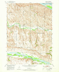
1952 Map of Monowi
USGS Topo · Published 1952About this map
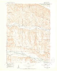
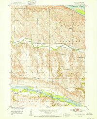
The village of Monowi stands as the central settlement in this early 1950s survey, positioned where the Chicago and North Western railway runs parallel to Ponca Creek. This rural landscape in Knox Co is defined by its educational and civic network, featuring numerous local schools such as School No 41, School No 42, and the Verdel Sch. To the south, the Niobrara River carves a wide, braided path through the terrain, while the northern edge is bounded by the Missouri River and the South Dakota border. For genealogists, the map preserves the exact locations of rural burial grounds like Beulah Cem and Alford Cem. The concentration of small schoolhouses and well-defined township sections like Bush and Raymond illustrates a mid-century agricultural community prior to the consolidation that would later transform the Nebraska-South Dakota borderlands.
Find a feature on this map
32 named features on this map. Tap any name to fly to it.
Don’t see what you’re looking for? This feature index may not catch every label — zoom into the map to look around manually.
Map Details
Editions of this 1952 Monowi Map
2 editions found
Historical Maps of Monowi Through Time
6 maps found