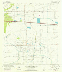
1961 Map of Monroe City
USGS Topo · Published 1978About this map
The Anahuac Oil Field dominates this portion of Chambers County, where an extensive network of pipelines and service roads underscores the region's mid-century petroleum industry. Settlement is concentrated around Monroe City and Hankamer, with family history markers like Broussard Cem and Whites Cem providing essential points of interest for genealogists. The landscape is defined by the transition from natural bayous to an engineered water system, including the Lone Star Canal and the Devers Canal, which support local agriculture and a Fish Hatchery. The intricate branching of the Double Bayou East Fork and Double Bayou West Fork meanders through the coastal prairie, alongside landmarks such as Barrow Slough and various pumping stations that reflect the area's dual reliance on ranching and oil production.
Find a feature on this map
25 named features on this map. Tap any name to fly to it.
Don’t see what you’re looking for? This feature index may not catch every label — zoom into the map to look around manually.
Map Details
Editions of this 1961 Monroe City Map
2 editions found
Other maps of this area

1942 · Anahuac
USGS Topo · 1:24,000

1943 · Whites Bayou
USGS Topo · 1:24,000

1943 · Sea Breeze
USGS Topo · 1:24,000

1943 · Stowell
USGS Topo · 1:24,000

1945 · Nolte
USGS Topo · 1:31,680

1945 · Sea Breeze
USGS Topo · 1:31,680

1950 · Houston
USGS Topo · 1:250,000

1956 · Houston
USGS Topo · 1:250,000
1961 · Anahuac
USGS Topo · 1:24,000
1961 · Monroe City
USGS Topo · 1:24,000