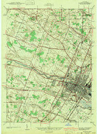
1942 Map of Monroe
USGS Topo · Published 1942About this map
The Raisin River flows through the heart of Monroe, Michigan, serving as the central axis for this early 1940s landscape. This survey by H. E. Simmons and H. W. Toy illustrates a city well-integrated with its industrial and institutional surroundings, featuring a dense network of schools like Waterloo Sch and the extensive grounds of St Marys Academy. The era's transportation infrastructure is particularly prominent, with the Michigan Central and New York Central railroads converging near the city center, alongside the Detroit and Toledo Shore Line running parallel to the coast.
Find a feature on this map
89 named features on this map. Tap any name to fly to it.
Don’t see what you’re looking for? This feature index may not catch every label — zoom into the map to look around manually.
Map Details
Editions of this 1942 Monroe Map
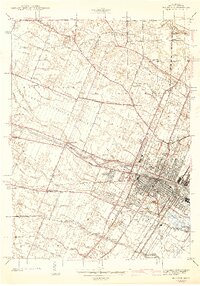
2 editions found
Other maps of this area

1902 · Ypsilanti
USGS Topo · 1:62,500

1904 · Ann Arbor
USGS Topo · 1:125,000

1906 · Ypsilanti
USGS Topo · 1:62,500

1906 · Romulus
USGS Topo · 1:62,500

1908 · Ann Arbor
USGS Topo · 1:125,000

1912 · Monroe
USGS Topo · 1:62,500

1912 · Dundee
USGS Topo · 1:62,500

1914 · Monroe
USGS Topo · 1:62,500

1926 · Dundee
USGS Topo · 1:62,500

1927 · Monroe
USGS Topo · 1:31,680
Featured Places
- Frenchtown Charter Township, MI
- Monroe, MI
- Monroe Charter Township, MI
- South Monroe, Monroe Charter Township
- Raisinville Township, MI