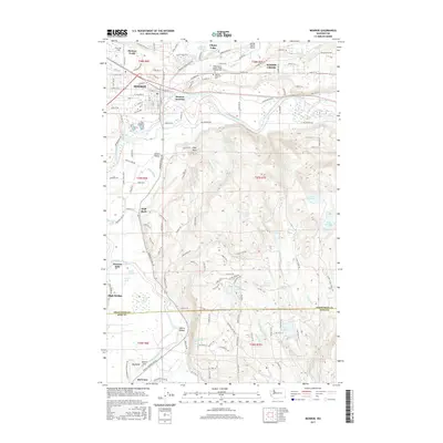
2017 Map of Monroe
USGS Topo · Published 2017About this map
The Skykomish River and Snoqualmie River converge just west of this 2017 survey area, defining a landscape of fertile valley floors and rising upland plateaus. The city of Monroe serves as the primary hub, where the BNSF Railway parallels the river and connects the town to Monroe Junction. This region is characterized by its complex hydrology, featuring numerous swamps and smaller lakes such as Lake Fontal, Lake Hannan, and the Johnsons Swamp complex.
Find a feature on this map
145 named features on this map. Tap any name to fly to it.
Don’t see what you’re looking for? This feature index may not catch every label — zoom into the map to look around manually.
Map Details
Editions of this 2017 Monroe Map
This is the sole edition of this map. No revisions or reprints were ever made.
Other maps of this area

1895 · Snohomish
USGS Topo · 1:125,000

1897 · Seattle
USGS Topo · 1:125,000

1921 · Sultan
USGS Topo · 1:125,000

1923 · Sultan
USGS Topo · 1:125,000

1944 · Everett
USGS Topo · 1:62,500

1950 · Redmond
USGS Topo · 1:24,000

1953 · Sultan
USGS Topo · 1:24,000

1953 · Lake Joy
USGS Topo · 1:24,000

1953 · Monroe
USGS Topo · 1:24,000
1953 · Maltby
USGS Topo · 1:24,000