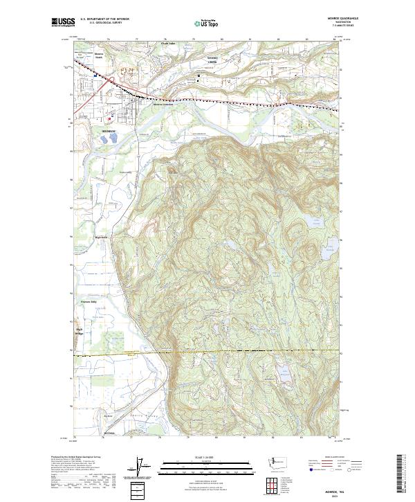
2023 Map of Monroe
USGS Topo · Published 2023About this map
The Skykomish River and Snoqualmie River define the hydraulic character of this Snohomish County landscape, winding through a complex system of sloughs and oxbow lakes. The city of Monroe sits at a geographic hub where Monroe North and Monroe Junction meet the river valley. To the south, the valley floor transitions into the Tualco Valley and the prominent rising terrain of High Rock. Local history is anchored by the Odd Fellows Cem North and Odd Fellows Cem South, situated near the early aviation grounds of First Air Field. The map records a dense network of upland water bodies including Lake Fontal, Lake Hannan, and Lake Margaret, tucked into the drainages of Hannan Creek and Cherry Creek. Small settlements like Cherry Valley and Pearson Eddy reflect the historical rural footprint of the region.
Find a feature on this map
122 named features on this map. Tap any name to fly to it.
Don’t see what you’re looking for? This feature index may not catch every label — zoom into the map to look around manually.
Map Details
Editions of this 2023 Monroe Map
This is the sole edition of this map. No revisions or reprints were ever made.
Other maps of this area

1895 · Snohomish
USGS Topo · 1:125,000

1897 · Seattle
USGS Topo · 1:125,000

1921 · Sultan
USGS Topo · 1:125,000

1923 · Sultan
USGS Topo · 1:125,000

1944 · Everett
USGS Topo · 1:62,500

1950 · Redmond
USGS Topo · 1:24,000

1953 · Sultan
USGS Topo · 1:24,000

1953 · Lake Joy
USGS Topo · 1:24,000

1953 · Monroe
USGS Topo · 1:24,000
1953 · Maltby
USGS Topo · 1:24,000