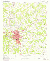
1964 Map of Monroe
USGS Topo · Published 1975About this map
Monroe serves as the focal point of this Walton County landscape, shown during a period of mid-century growth that necessitated revisions for expanding urban areas. The town center is densely detailed with civic infrastructure, including the Mem Library, City Hall, and the Nowell PO. Educational and community life is anchored by Carver High Sch and the Recreation Center, while the outskirts transition into a rolling terrain drained by Jacks Creek and Hard Labor Creek.
Find a feature on this map
65 named features on this map. Tap any name to fly to it.
Don’t see what you’re looking for? This feature index may not catch every label — zoom into the map to look around manually.
Map Details
Editions of this 1964 Monroe Map
3 editions found
Other maps of this area

1896 · Monroe
USGS Topo · 1:125,000

1953 · Athens
USGS Topo · 1:250,000

1958 · Athens
USGS Topo · 1:250,000

1959 · Athens
USGS Topo · 1:250,000

1963 · Athens
USGS Topo · 1:250,000

1964 · Bold Springs
USGS Topo · 1:24,000

1964 · Between
USGS Topo · 1:24,000

1964 · High Shoals
USGS Topo · 1:24,000

1964 · Monroe
USGS Topo · 1:24,000

1964 · Winder South
USGS Topo · 1:24,000