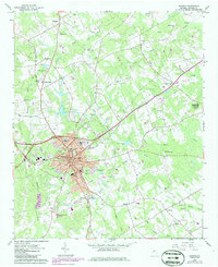
1964 Map of Monroe
USGS Topo · Published 1986About this map
Monroe serves as the focal point of this mid-century Walton County survey, situated at the junction of the Seaboard railroad and major regional roads like Cherry Hill Road. The town core is dense with civic landmarks, including the Monroe High Sch, Carver High Sch, and the Nowell Recreation Center. Expansion is evident near the Monroe-Walton County Airport, where municipal infrastructure like the Sewage Disposal Pond and various Substations support growing residential needs.
Find a feature on this map
91 named features on this map. Tap any name to fly to it.
Don’t see what you’re looking for? This feature index may not catch every label — zoom into the map to look around manually.
Map Details
Editions of this 1964 Monroe Map
3 editions found
Other maps of this area

1896 · Monroe
USGS Topo · 1:125,000

1953 · Athens
USGS Topo · 1:250,000

1958 · Athens
USGS Topo · 1:250,000

1959 · Athens
USGS Topo · 1:250,000

1963 · Athens
USGS Topo · 1:250,000

1964 · Bold Springs
USGS Topo · 1:24,000

1964 · Between
USGS Topo · 1:24,000

1964 · High Shoals
USGS Topo · 1:24,000

1964 · Monroe
USGS Topo · 1:24,000

1964 · Winder South
USGS Topo · 1:24,000