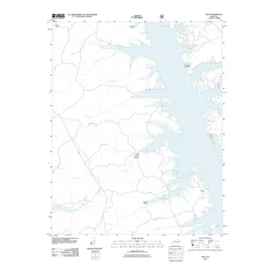
2010 Map of Mont
USGS Topo · Published 2010About this map
Lake Barkley dominates the eastern half of this landscape, its intricate shoreline creating a complex network of bays and inlets that reach into the surrounding terrain. Small settlements and points of interest like Commerce Landing and Mont sit along these waters, reflecting the area's relationship with the reservoir. To the west, the land is carved by numerous drainages such as Mammoth Furnace Creek, Hurricane Creek, and Cravens Creek, interspersed with local landmarks like Racetrack Hollow and Curry Hollow. Several graveyards, including Henderson Chapel Cemetery and Saint Stevens Cemetery, are preserved in the hills above the waterline. The mapping of internal water bodies like Honker Lake and Hematite Lake suggests a managed natural area, while roads such as Mulberry Flat Rd and Woodson Chapel Rd provide the primary access through this wooded and aqueous environment.
Find a feature on this map
30 named features on this map. Tap any name to fly to it.
Don’t see what you’re looking for? This feature index may not catch every label — zoom into the map to look around manually.
Map Details
Editions of this 2010 Mont Map
This is the sole edition of this map. No revisions or reprints were ever made.
Other maps of this area

1908 · Princeton
USGS Topo · 1:62,500

1910 · Princeton
USGS Topo · 1:62,500

1928 · Eddyville
USGS Topo · 1:48,000

1931 · Eddyville
USGS Topo · 1:62,500

1936 · Eddyville
USGS Topo · 1:48,000

1936 · Mont
USGS Topo · 1:24,000

1936 · Fenton
USGS Topo · 1:24,000

1936 · Grand Rivers
USGS Topo · 1:24,000

1936 · Hiatt
USGS Topo · 1:24,000

1936 · Birmingham
USGS Topo · 1:24,000