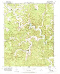
1951 Map of Montauk
USGS Topo · Published 1970About this map
Montauk State Park sits at the heart of this mid-century landscape, where the waters of Montauk Springs feed into the Current River. The area's topography is defined by deeply carved hollows and prominent bluffs, supporting a community anchored by rural institutions like Fairview Sch, Ashley Sch, and the Upper Hepsida Sch. At the settlement of Montauk, the presence of a Fish Hatchery and numerous river crossings labeled as Ford indicates the significance of the river to both the local economy and early state-managed conservation efforts.
Find a feature on this map
38 named features on this map. Tap any name to fly to it.
Don’t see what you’re looking for? This feature index may not catch every label — zoom into the map to look around manually.
Map Details
Editions of this 1951 Montauk Map
5 editions found
Other maps of this area

1932 · Cedar Grove
USGS Topo · 1:48,000

1937 · Edgar Springs
USGS Topo · 1:48,000

1941 · Salem
USGS Topo · 1:62,500

1945 · Salem
USGS Topo · 1:62,500

1945 · Edgar Springs
USGS Topo · 1:62,500

1949 · Rolla
USGS Topo · 1:250,000

1951 · Montauk
USGS Topo · 1:24,000

1951 · Licking
USGS Topo · 1:24,000

1951 · Cedargrove
USGS Topo · 1:24,000

1951 · Raymondville
USGS Topo · 1:24,000