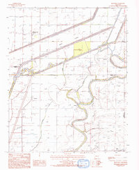
1984 Map of Monterey
USGS Topo · Published 1993About this map
The St Francis River meanders through the heart of the Arkansas Delta in this mid-1980s landscape, defined by a complex network of levees and flood control measures. The area around Monterey and Twist shows the extensive modification of the natural hydrology, where Wolf Slough and Hog Slough are integrated into a system of drainage ditches and an Irr Canal. This terrain is representative of the intensive agricultural development in the region, with the large Floodway protecting the fertile bottoms between the river and the boundary of Poinsett and Cross Counties. The presence of the Landing Strip and named locations like Anderson Tully (Stewart) reflects the industrial-scale farming and timber operations that shaped the local economy. Researchers can trace the intersection of three counties and the intricate levee systems built to manage the persistent waters of the Fortune Slough and Beaver Slough basins.
Find a feature on this map
15 named features on this map. Tap any name to fly to it.
Don’t see what you’re looking for? This feature index may not catch every label — zoom into the map to look around manually.
Map Details
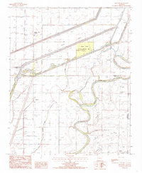
Editions of this 1984 Monterey Map
2 editions found
Other maps of this area

1940 · Deckerville
USGS Topo · 1:62,500

1940 · Princedale
USGS Topo · 1:62,500

1940 · Dee
USGS Topo · 1:62,500

1941 · Marked Tree
USGS Topo · 1:62,500

1953 · Memphis
USGS Topo · 1:250,000

1956 · Marked Tree
USGS Topo · 1:62,500

1956 · Memphis
USGS Topo · 1:250,000

1956 · Princedale
USGS Topo · 1:62,500

1957 · Deckerville
USGS Topo · 1:62,500

1958 · Dee
USGS Topo · 1:62,500