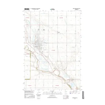
2016 Map of Montevideo
USGS Topo · Published 2016About this map
The confluence of the Chippewa River and the Minnesota River anchors this study of the landscape surrounding Montevideo, where water and rail corridors dictated the growth of the region. The map highlights a complex hydrographic system featuring Carlton Lake, Cedar Lake, and winding backwaters like Long Slough and Round Slough. These features reflect the alluvial character of the river valley as it transitions into the upland agricultural plains. In the southeast, the settlement of Wegdahl sits near the river bend, while the northern reaches are defined by essential infrastructure including the Montevideo-Chippewa County Airport and an extensive grid of section roads and drainage features like County Ditch Number Sixtyseven. Genealogists will find significant value in the distribution of local burial sites, from the Saint Joseph Cem near the city center to more outlying locations such as the Strombeck Cem and Black Oak Lake Cem.
Find a feature on this map
64 named features on this map. Tap any name to fly to it.
Don’t see what you’re looking for? This feature index may not catch every label — zoom into the map to look around manually.
Map Details
Editions of this 2016 Montevideo Map
This is the sole edition of this map. No revisions or reprints were ever made.
Other maps of this area

1953 · New Ulm
USGS Topo · 1:250,000

1953 · Saint Cloud
USGS Topo · 1:250,000

1957 · Saint Cloud
USGS Topo · 1:250,000

1957 · New Ulm
USGS Topo · 1:250,000

1958 · New Ulm
USGS Topo · 1:250,000

1958 · Saint Cloud
USGS Topo · 1:250,000

1958 · Watson
USGS Topo · 1:24,000

1958 · Gracelock
USGS Topo · 1:24,000

1958 · Gracelock SW
USGS Topo · 1:24,000

1965 · Montevideo
USGS Topo · 1:24,000