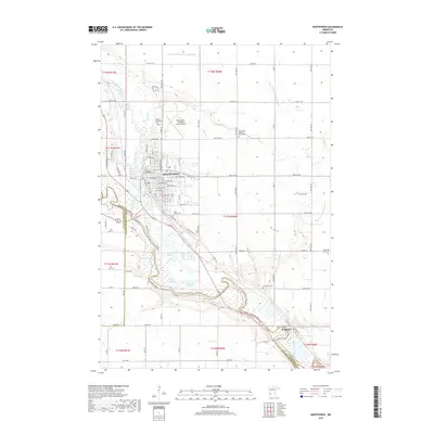
2019 Map of Montevideo
USGS Topo · Published 2019About this map
The Montevideo townsite occupies a strategic position at the confluence of the Chippewa River and the Minnesota River, serving as a central hub for the surrounding agricultural landscape in Chippewa County. This modern survey illustrates the dense residential street grid of the city, bounded by major local thoroughfares like Black Oak Ave and Wolfe Ave. The topography is defined by the broad, low-lying river valleys which contain complex wetland systems, including Long Slough, Round Slough, and Carlton Lake. Outside the city center, the map documents the rural settlement pattern, highlighted by established cemeteries such as Saint John's Lutheran Church Cem and the Sunset Memorial Cem. Significant infrastructure like the Montevideo-Chippewa County Airport and the smaller community of Wegdahl to the southeast are clearly delineated, reflecting the area's continued role as a regional transport and service center near the Yellow Medicine County line.
Find a feature on this map
58 named features on this map. Tap any name to fly to it.
Don’t see what you’re looking for? This feature index may not catch every label — zoom into the map to look around manually.
Map Details
Editions of this 2019 Montevideo Map
This is the sole edition of this map. No revisions or reprints were ever made.
Other maps of this area

1953 · New Ulm
USGS Topo · 1:250,000

1953 · Saint Cloud
USGS Topo · 1:250,000

1957 · Saint Cloud
USGS Topo · 1:250,000

1957 · New Ulm
USGS Topo · 1:250,000

1958 · New Ulm
USGS Topo · 1:250,000

1958 · Saint Cloud
USGS Topo · 1:250,000

1958 · Watson
USGS Topo · 1:24,000

1958 · Gracelock
USGS Topo · 1:24,000

1958 · Gracelock SW
USGS Topo · 1:24,000

1965 · Montevideo
USGS Topo · 1:24,000