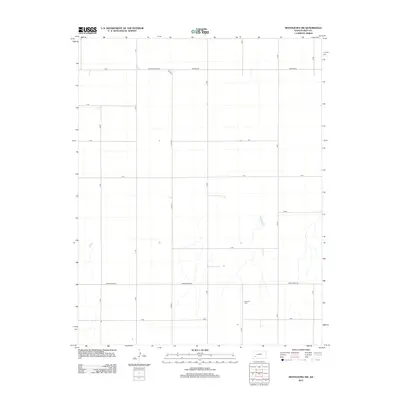
2012 Map of Montezuma NW
USGS Topo · Published 2012About this map
Fairview Cem serves as a primary historical waypoint in this corner of Gray County, situated along 14 Rd north of Z Rd. The landscape is defined by a rigorous grid of section-line roads, such as Monte Ingalls Rd and Ford Ensign Rd, which reflect the structured agricultural development of the High Plains. Drainage patterns are sparse, with intermittent water features appearing primarily in the southeastern portion of the map. This 2012 survey by the U.S. Geological Survey details the rural infrastructure of the region, emphasizing the connectivity provided by numbered routes like 10 Rd through 16 Rd. The layout of these transit corridors, including Beeson Rd and U Rd, illustrates the methodical division of land that has persisted since early settlement.
Find a feature on this map
18 named features on this map. Tap any name to fly to it.
Don’t see what you’re looking for? This feature index may not catch every label — zoom into the map to look around manually.
Map Details
Editions of this 2012 Montezuma NW Map
This is the sole edition of this map. No revisions or reprints were ever made.
Other maps of this area

1892 · Dodge
USGS Topo · 1:125,000

1896 · Garden
USGS Topo · 1:125,000

1955 · Dodge City
USGS Topo · 1:250,000

1958 · Dodge City
USGS Topo · 1:250,000

1959 · Dodge City
USGS Topo · 1:250,000

1968 · Montezuma
USGS Topo · 1:24,000

1968 · Ingalls
USGS Topo · 1:24,000

1968 · Montezuma NW
USGS Topo · 1:24,000

1968 · Cimarron
USGS Topo · 1:24,000
1968 · Charleston
USGS Topo · 1:24,000