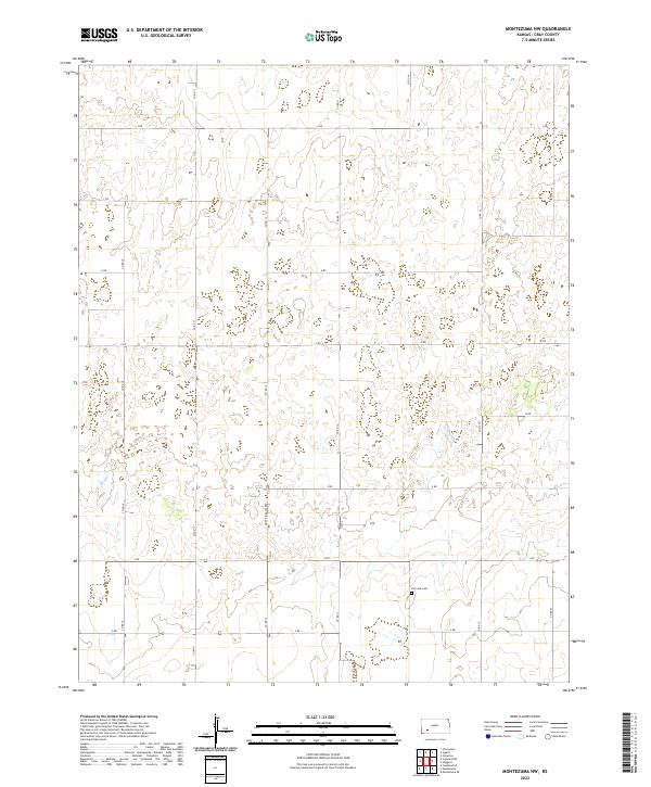
2022 Map of Montezuma NW
USGS Topo · Published 2022About this map
The agricultural plains of Gray County are defined here by a precise grid of rural thoroughfares, including the distinctively named Monte Ingalls Rd which cuts north-south through the center of the survey area. This high-plains landscape is typical of western Kansas, where transportation relies on a lettered and numbered road system such as S Rd and Co Rd 11 that segment the vast townships. Located in the southeastern portion of the map, Fairview Cem serves as a critical local landmark for genealogists and local historians, representing a quiet focal point for the surrounding farmsteads. The terrain is marked by subtle depressions and drainage patterns, with roads like Z Rd and Co Rd 14 providing access to the open range and cultivated fields within the sections of T27S R28W and T28S R29W.
Find a feature on this map
23 named features on this map. Tap any name to fly to it.
Don’t see what you’re looking for? This feature index may not catch every label — zoom into the map to look around manually.
Map Details
Editions of this 2022 Montezuma NW Map
This is the sole edition of this map. No revisions or reprints were ever made.
Other maps of this area

1892 · Dodge
USGS Topo · 1:125,000

1896 · Garden
USGS Topo · 1:125,000

1955 · Dodge City
USGS Topo · 1:250,000

1958 · Dodge City
USGS Topo · 1:250,000

1959 · Dodge City
USGS Topo · 1:250,000

1968 · Montezuma
USGS Topo · 1:24,000

1968 · Ingalls
USGS Topo · 1:24,000

1968 · Montezuma NW
USGS Topo · 1:24,000

1968 · Cimarron
USGS Topo · 1:24,000
1968 · Charleston
USGS Topo · 1:24,000