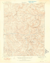
1924 Map of Montezuma
USGS Topo · Published 1924About this map
Montezuma sits at the heart of this high-altitude survey, serving as a hub for the heavy silver and gold mining operations that dominated the late 19th and early 20th centuries. The landscape is defined by the Continental Divide, which separates the waters of the Middle Fork Williams River and Clear Creek while hosting a network of industrial tunnels and shafts. Engineering feats of the era are visible in the high-elevation transport routes, including the climb to Argentine Pass and the winding approach to Loveland Pass.
Find a feature on this map
128 named features on this map. Tap any name to fly to it.
Don’t see what you’re looking for? This feature index may not catch every label — zoom into the map to look around manually.
Map Details
Editions of this 1924 Montezuma Map
2 editions found
Other maps of this area

1889 · Leadville
USGS Topo · 1:125,000

1891 · Leadville
USGS Topo · 1:125,000

1903 · Georgetown
USGS Topo · 1:62,500

1905 · Central City
USGS Topo · 1:62,500

1905 · Georgetown
USGS Topo · 1:62,500

1910 · Central City
USGS Topo · 1:62,500

1912 · Central City
USGS Topo · 1:62,500

1924 · Montezuma
USGS Topo · 1:62,500

1924 · Fraser
USGS Topo · 1:62,500

1926 · Fraser
USGS Topo · 1:62,500