2022 Map of Montfort
USGS Topo · Published 2022About this map
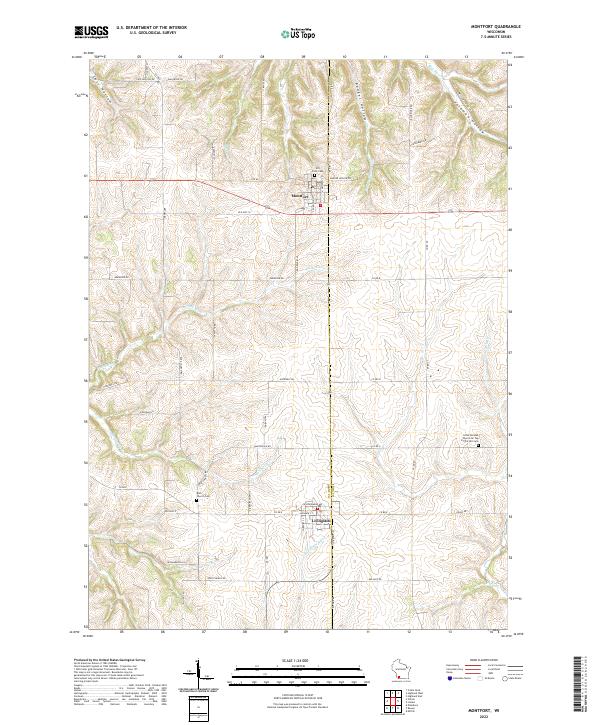
Montfort and Livingston anchor this modern survey of the Driftless Area landscape along the boundary of Grant Co and Iowa Co. The terrain is defined by a dense network of dendritic drainage patterns, where ridges carry local routes like Old Hwy 18 and Ebenezer Rd above the carved valleys of the Platte River and Blue River. Genealogists and local historians will find several well-preserved landmarks of early settlement, most notably the Little German Church On Top Of The Hill Cem in the eastern hills and the Rock Church Cem near the Martinville Cr headwaters. The map illustrates how current infrastructure, such as Cass Hollow Rd and Laufenberg Rd, continues to follow the natural contours of landmarks like Badger Hollow and Foreman Hollow, preserving the rural layout established by generations of farming families.
Find a feature on this map
35 named features on this map. Tap any name to fly to it.
Don’t see what you’re looking for? This feature index may not catch every label — zoom into the map to look around manually.
Map Details
Editions of this 2022 Montfort Map
This is the sole edition of this map. No revisions or reprints were ever made.