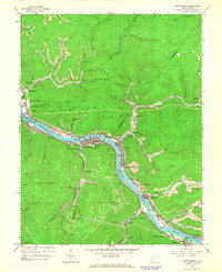
1965 Map of Montgomery
USGS Topo · Published 1966About this map
The Kanawha River serves as the industrial and social backbone of this coal-country landscape during the mid-1960s, winding through a steep valley lined with interconnected company towns and rail lines. Modern river navigation is anchored by the London Lock & Dam No 3, while the town of Montgomery stands out as a regional hub, home to the State Institute of Technology. The dual presence of the Chesapeake and Ohio Railway and the New York Central Railroad on opposing banks illustrates the intense logistical demands of the region's extraction economy.
Find a feature on this map
79 named features on this map. Tap any name to fly to it.
Don’t see what you’re looking for? This feature index may not catch every label — zoom into the map to look around manually.
Map Details
Editions of this 1965 Montgomery Map
2 editions found
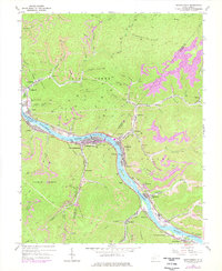
Other maps of this area

1897 · Kanawha Falls
USGS Topo · 1:125,000

1900 · Kanawha Falls
USGS Topo · 1:125,000

1901 · Kanawha Falls
USGS Topo · 1:125,000

1907 · Clendenin
USGS Topo · 1:62,500

1908 · Clay
USGS Topo · 1:48,000

1908 · Fayetteville
USGS Topo · 1:48,000

1908 · Montgomery
USGS Topo · 1:48,000

1909 · Clendenin
USGS Topo · 1:62,500

1910 · Clay
USGS Topo · 1:62,500

1910 · Fayetteville
USGS Topo · 1:62,500