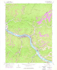
1965 Map of Montgomery
USGS Topo · Published 1977About this map
The Kanawha River serves as the industrial and social backbone for this region of the Kanawha and Fayette county line, where the valley floor is densely packed with coal-era settlements and infrastructure. The city of Montgomery is prominent, hosting the West Virginia Institute of Technology and surrounded by smaller communities like Smithers, London, and Handley. This mid-century landscape is defined by the heavy presence of the Chesapeake and Ohio and Conrail railroads, which parallel the river to serve the numerous strip mines and air shafts dotting the surrounding highlands.
Find a feature on this map
81 named features on this map. Tap any name to fly to it.
Don’t see what you’re looking for? This feature index may not catch every label — zoom into the map to look around manually.
Map Details
Editions of this 1965 Montgomery Map
2 editions found
Other maps of this area

1897 · Kanawha Falls
USGS Topo · 1:125,000

1900 · Kanawha Falls
USGS Topo · 1:125,000

1901 · Kanawha Falls
USGS Topo · 1:125,000

1907 · Clendenin
USGS Topo · 1:62,500

1908 · Clay
USGS Topo · 1:48,000

1908 · Fayetteville
USGS Topo · 1:48,000

1908 · Montgomery
USGS Topo · 1:48,000

1909 · Clendenin
USGS Topo · 1:62,500

1910 · Clay
USGS Topo · 1:62,500

1910 · Fayetteville
USGS Topo · 1:62,500