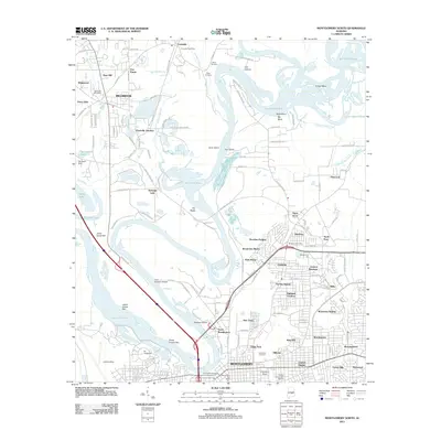
2011 Map of Montgomery North
USGS Topo · Published 2011About this map
Montgomery is shown here in detail during a period of urban expansion along the south bank of the Alabama River, where the Tallapoosa River joins the main channel. The map highlights the complex hydrologic landscape north of the city, dominated by the Gun Island Chute and a series of islands and bars including Gum Island, Buzzard Island, and Three Chutes Bar. These features, along with Jacksons Lake and Crescent Lake, define the riparian character of the northern suburbs.
Find a feature on this map
139 named features on this map. Tap any name to fly to it.
Don’t see what you’re looking for? This feature index may not catch every label — zoom into the map to look around manually.
Map Details
Editions of this 2011 Montgomery North Map
This is the sole edition of this map. No revisions or reprints were ever made.
Other maps of this area

1901 · Wetumpka
USGS Topo · 1:125,000

1901 · Wetumpka
USGS Topo · 1:62,500

1903 · Wetumpka
USGS Topo · 1:125,000

1927 · Montgomery
USGS Topo · 1:48,000

1930 · Montgomery
USGS Topo · 1:62,500

1953 · Montgomery
USGS Topo · 1:250,000

1956 · Montgomery
USGS Topo · 1:250,000

1957 · Montgomery
USGS Topo · 1:250,000

1958 · Montgomery
USGS Topo · 1:62,500

1958 · Montgomery North
USGS Topo · 1:24,000