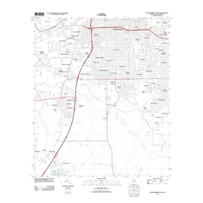
2011 Map of Montgomery South
USGS Topo · Published 2011About this map
Catoma Creek meanders across the southern landscape of this Montgomery County quadrangle, dividing the dense urban grid of the state capital from the expanding developments and agricultural lands to the south. This 2011 survey illustrates the city’s southward reach through neighborhoods such as Western Hills, Highland Village, and English Village, while also preserving the locations of numerous historic burial grounds including Westcott Cemetery and Remount Park Cemetery. Further south, the landscape shifts toward lower-density residential clusters like Hope Hull and the lakeside community of Lagos del Sol. The presence of specialized infrastructure, such as the Baptist Medical Center Airport and several water management structures like Fisher Dam and Frank Davis Dam, highlights the 21st-century requirements of a growing metropolitan area. Academic institutions including Faulkner University and Starke University School anchor the northern residential districts.
Find a feature on this map
146 named features on this map. Tap any name to fly to it.
Don’t see what you’re looking for? This feature index may not catch every label — zoom into the map to look around manually.
Map Details
Editions of this 2011 Montgomery South Map
This is the sole edition of this map. No revisions or reprints were ever made.
Other maps of this area

1927 · Montgomery
USGS Topo · 1:48,000

1930 · Montgomery
USGS Topo · 1:62,500

1953 · Montgomery
USGS Topo · 1:250,000

1956 · Montgomery
USGS Topo · 1:250,000

1957 · Montgomery
USGS Topo · 1:250,000

1957 · Letohatchee
USGS Topo · 1:62,500

1958 · Montgomery
USGS Topo · 1:62,500

1958 · Montgomery North
USGS Topo · 1:24,000

1958 · Montgomery South
USGS Topo · 1:24,000

1958 · Mount Meigs
USGS Topo · 1:62,500