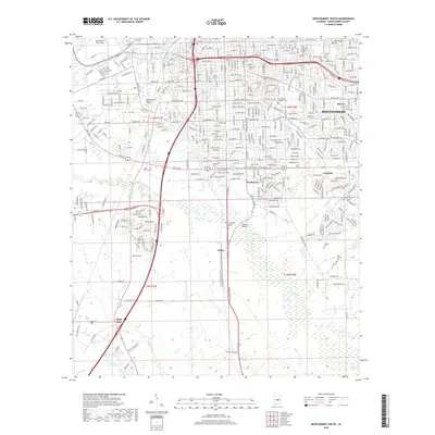
2018 Map of Montgomery South
USGS Topo · Published 2018About this map
Montgomery dominates the northern half of this landscape, showing a dense network of residential streets and educational campuses like Alabama State University and Huntingdon College. The southern half transitions into more open terrain defined by the winding course of Catoma Creek and Baldwin Slough. This division highlights the city's southward expansion toward suburban enclaves like Southmont and Hillake.
Find a feature on this map
55 named features on this map. Tap any name to fly to it.
Don’t see what you’re looking for? This feature index may not catch every label — zoom into the map to look around manually.
Map Details
Editions of this 2018 Montgomery South Map
This is the sole edition of this map. No revisions or reprints were ever made.
Other maps of this area

1927 · Montgomery
USGS Topo · 1:48,000

1930 · Montgomery
USGS Topo · 1:62,500

1953 · Montgomery
USGS Topo · 1:250,000

1956 · Montgomery
USGS Topo · 1:250,000

1957 · Montgomery
USGS Topo · 1:250,000

1957 · Letohatchee
USGS Topo · 1:62,500

1958 · Montgomery
USGS Topo · 1:62,500

1958 · Montgomery North
USGS Topo · 1:24,000

1958 · Montgomery South
USGS Topo · 1:24,000

1958 · Mount Meigs
USGS Topo · 1:62,500