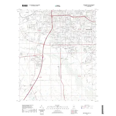
2020 Map of Montgomery South
USGS Topo · Published 2020About this map
Montgomery anchors the northern portion of this map, showcasing the dense urban infrastructure of the state capital alongside its academic and military foundations. The campus of Alabama State University and Huntingdon College are prominent, while Maxwell Air Force Base occupies the northwestern corner. As the city grid gives way to the south, the landscape transitions into the floodplain of Catoma Creek and Baldwin Slough. This southern reach includes several dispersed residential communities such as Southmont, Lynndale, and Hope Hull. Genealogists will find several burial grounds across the area, ranging from the large Greenwood and Lincoln cemeteries near the city center to smaller, more rural sites like Troy Chapel Cem and Joseph Cem. The intersection of civic life and natural geography is clear at the Montgomery County Courthouse and where Norman Bridge spans the local waterways.
Find a feature on this map
370 named features on this map. Tap any name to fly to it.
Don’t see what you’re looking for? This feature index may not catch every label — zoom into the map to look around manually.
Map Details
Editions of this 2020 Montgomery South Map
This is the sole edition of this map. No revisions or reprints were ever made.
Other maps of this area

1927 · Montgomery
USGS Topo · 1:48,000

1930 · Montgomery
USGS Topo · 1:62,500

1953 · Montgomery
USGS Topo · 1:250,000

1956 · Montgomery
USGS Topo · 1:250,000

1957 · Montgomery
USGS Topo · 1:250,000

1957 · Letohatchee
USGS Topo · 1:62,500

1958 · Montgomery
USGS Topo · 1:62,500

1958 · Montgomery North
USGS Topo · 1:24,000

1958 · Montgomery South
USGS Topo · 1:24,000

1958 · Mount Meigs
USGS Topo · 1:62,500