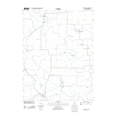
2012 Map of Monticello
USGS Topo · Published 2012About this map
Monticello sits at the northern bend of the North Fabius River, serving as a focal point for this Lewis County landscape. The area is characterized by the parallel courses of the North and Middle Fabius River, which together carve a complex drainage pattern across the central Missouri countryside. Smaller settlements like Gilead, Tolona, and Ewing are connected by a network of county roads, showing the persistent rural settlement patterns of the early 21st century.
Find a feature on this map
57 named features on this map. Tap any name to fly to it.
Don’t see what you’re looking for? This feature index may not catch every label — zoom into the map to look around manually.
Map Details
Editions of this 2012 Monticello Map
This is the sole edition of this map. No revisions or reprints were ever made.
Other maps of this area

1903 · Kahoka
USGS Topo · 1:125,000

1903 · Palmyra
USGS Topo · 1:125,000

1948 · Quincy
USGS Topo · 1:250,000

1949 · Durham
USGS Topo · 1:24,000

1949 · Maywood
USGS Topo · 1:24,000
1950 · Maywood
USGS Topo · 1:24,000

1950 · Durham
USGS Topo · 1:24,000

1950 · La Grange
USGS Topo · 1:24,000

1950 · Benjamin
USGS Topo · 1:24,000

1950 · Williamstown
USGS Topo · 1:24,000