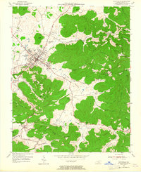
1953 Map of Monticello
USGS Topo · Published 1965About this map
Monticello serves as the focal point for this mid-century portrait of Wayne County, where the transition from town streets to the deeply dissected terrain of the Cumberland Plateau is clearly visible. The landscape is defined by long, fertile corridors such as Beech Valley and Elk Spring Valley, which are hemmed in by steep features like Elk Ridge and Coffey Mountain. This topographical pattern dictated the placement of early settlements and rural infrastructure, seen in the scattering of country schools like No 2 School and Travis School.
Find a feature on this map
53 named features on this map. Tap any name to fly to it.
Don’t see what you’re looking for? This feature index may not catch every label — zoom into the map to look around manually.
Map Details
Editions of this 1953 Monticello Map
2 editions found
Other maps of this area

1911 · Monticello
USGS Topo · 1:62,500

1914 · Monticello
USGS Topo · 1:62,500

1932 · Burnside
USGS Topo · 1:62,500

1934 · Barthell
USGS Topo · 1:62,500

1934 · Pall Mall
USGS Topo · 1:62,500

1953 · Frazer
USGS Topo · 1:24,000

1953 · Parnell
USGS Topo · 1:24,000

1953 · Monticello
USGS Topo · 1:24,000

1953 · Mill Springs
USGS Topo · 1:24,000

1954 · Jabez
USGS Topo · 1:24,000