
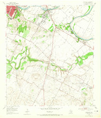
1955 Map of Montopolis
USGS Topo · Published 1956About this map
The southeastern outskirts of Austin transition from suburban growth to a rural, creek-carved landscape along the Colorado River in the mid-1950s. The community of Montopolis serves as a central hub, flanked by the Austin Country Club and industrial elements like the Livestock Sales Barn and numerous Gravel Pits that suggest the era's physical expansion. South of the City Bdy, the terrain becomes defined by the winding paths of Onion Creek and Williamson Creek, where small settlements like Del Valle and Colton maintain their own local identities through landmarks such as Popham Sch and Salem Ch.
Find a feature on this map
38 named features on this map. Tap any name to fly to it.
Don’t see what you’re looking for? This feature index may not catch every label — zoom into the map to look around manually.
Map Details
Editions of this 1955 Montopolis Map
2 editions found
Other maps of this area

1896 · Austin
USGS Topo · 1:125,000

1897 · Austin
USGS Topo · 1:125,000

1910 · Austin
USGS Topo · 1:125,000

1932 · Mt. Bonnell
USGS Topo · 1:62,500

1954 · Austin East
USGS Topo · 1:24,000

1954 · Austin West
USGS Topo · 1:24,000

1954 · Austin
USGS Topo · 1:250,000

1955 · Oak Hill
USGS Topo · 1:24,000

1955 · Montopolis
USGS Topo · 1:62,500
1955 · Austin
USGS Topo · 1:62,500