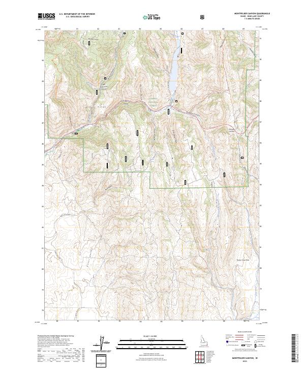
2023 Map of Montpelier Canyon
USGS Topo · Published 2023About this map
The Preuss Range dominates this portion of the Caribou National Forest in Bear Lake County, Idaho. The map documents a landscape defined by deep canyons and seasonal drainage systems, centered on the transit corridor of Montpelier Canyon. Elevation shifts are marked by significant landmarks like Geneva Summit and the high peaks of the Sheep Creek Hills. The drainage network includes Montpelier Creek, Crow Creek, and the West Fork Sheep Creek, which carve through varied terrain such as Banks Valley and Home Canyon. Historical land use is suggested by family-named features like Gertsch Canyon, Bischoff Canyon, and Aegertter Hollow, alongside remote resources like Willow Spring. This modern survey provides a detailed look at the trail systems and forest roads, including the Joe's Gap Trl and Telephone Draw Trl, that provide access to these high-altitude Idaho basins.
Find a feature on this map
39 named features on this map. Tap any name to fly to it.
Don’t see what you’re looking for? This feature index may not catch every label — zoom into the map to look around manually.
Map Details
Editions of this 2023 Montpelier Canyon Map
This is the sole edition of this map. No revisions or reprints were ever made.
Other maps of this area

1909 · Montpelier
USGS Topo · 1:125,000

1911 · Montpelier
USGS Topo · 1:125,000

1955 · Preston
USGS Topo · 1:250,000

1958 · Preston
USGS Topo · 1:250,000

1962 · Preston
USGS Topo · 1:250,000

1967 · Montpelier
USGS Topo · 1:24,000

1967 · Dingle
USGS Topo · 1:24,000
1970 · Georgetown
USGS Topo · 1:24,000
1970 · Border
USGS Topo · 1:24,000
1970 · Montpelier Canyon
USGS Topo · 1:24,000