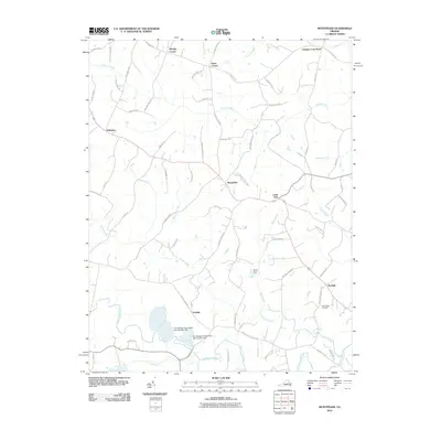
2010 Map of Montpelier
USGS Topo · Published 2010About this map
The South Anna River and Taylors Creek define the hydrologic character of this Hanover County landscape, where rural crossroads and modern industrial sites coexist. Industrial footprints are visible through The Feldspar Corporation Dam Number One and The Feldspar Corporation Dam Number Two near Gouldin, illustrating the local mineral extraction and land management practices of the early 21st century. The map preserves several local junction points such as Moodys Corner, Jones Corner, and Goshen Cross Road, which serve as anchors for the surrounding agricultural community.
Find a feature on this map
71 named features on this map. Tap any name to fly to it.
Don’t see what you’re looking for? This feature index may not catch every label — zoom into the map to look around manually.
Map Details
Editions of this 2010 Montpelier Map
This is the sole edition of this map. No revisions or reprints were ever made.
Other maps of this area

1890 · Goochland
USGS Topo · 1:125,000

1892 · Goochland
USGS Topo · 1:125,000

1936 · Glen Allen
USGS Topo · 1:24,000

1941 · Glen Allen
USGS Topo · 1:31,680

1942 · Buckner
USGS Topo · 1:24,000

1942 · Beaverdam
USGS Topo · 1:24,000

1943 · Mabelton
USGS Topo · 1:31,680
1943 · Hanover Academy
USGS Topo · 1:31,680

1943 · Perkinsville
USGS Topo · 1:31,680
1943 · Buckner
USGS Topo · 1:31,680